
DEM.Net alternatives and similar packages
Based on the "Gis" category.
Alternatively, view DEM.Net alternatives based on common mentions on social networks and blogs.
-
-
-
-
-
CoordinateSharp
A library designed to ease geographic coordinate format conversions, and determine sun/moon information in C# -
DEM Net Elevation API
Digital Elevation model library in C#. 3D terrain models, line/point Elevations, intervisibility reports

InfluxDB - Power Real-Time Data Analytics at Scale


* Code Quality Rankings and insights are calculated and provided by Lumnify.
They vary from L1 to L5 with "L5" being the highest.
Do you think we are missing an alternative of DEM.Net or a related project?

|
WorkOS - The modern identity platform for B2B SaaS
sponsored
workos.com
|
Popular Comparisons
-
DEM.NetvsGMap.NET
-
DEM.NetvsSharpMap
-
DEM.NetvsOsmSharp
-
DEM.NetvsNetTopologySuite
-
DEM.NetvsGeoJSON4EntityFramework

|
SaaSHub - Software Alternatives and Reviews
sponsored
www.saashub.com
|
README

![]()

DEM.Net.Core 
DEM.Net.glTF 
This library is licensed for personal use or for smal companies generating less than $100,000 annually, for any other cases, please get in touch with us.
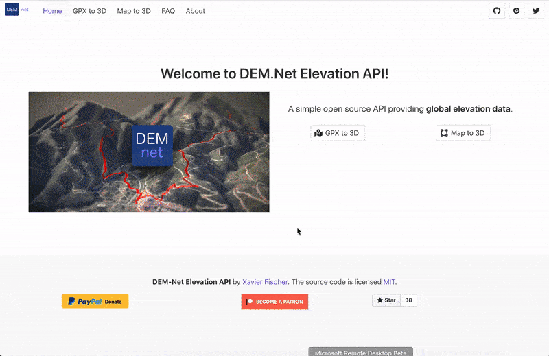
DEM.Net
Digital Elevation Model library in C#
- Elevation queries (point, polylines, heightmap, GPX)
- 3D export (glTF, STL)
- Imagery (MapBox, OSM, Stamen) : textured 3D models and normal maps
- No setup
- Automatic DEM file download from openTopography.org
- Fast and optimized queries
See samples here
Supported by 
Supported formats and datasets
Input
- GeoTIFF (JAXA AW3D, and any GeoTIFF)
- HGT (Nasa SRTM)
- netCDF ## Output
- glTF
- STL
Current dev status
- All incoming features are listed in the project board here : https://dev.azure.com/dem-net/elevationapi/_workitems/recentlyupdated/.
- Feel free to suggest any idea you'd like to see covered here in the issues : https://github.com/dem-net/DEM.Net/issues.
SampleApp
(Work in progress) SampleApp is a Console App used for test purposes, full of samples. It's pretty messy and lacks documentation but names are self explanatory.
How do I use the API ?
Raster operations
- Use
elevationService.DownloadMissingFiles(DEMDataSet.AW3D30, <bbox>)to download and generate metadata for a given dataset. - Supported datasets : SRTM GL1 and GL3 (HGT files), AWD30 (GeoTIFF)
- Use
new RasterService().GenerateReport(DEMDataSet.AW3D30, <bounding box>)to download only necessary tiles using remote VRT file. - Use
rasterService.GenerateFileMetadata(<path to file>, DEMFileFormat.GEOTIFF, false, false)to generate metada for an arbitrary file. - Use
RasterService.GenerateDirectoryMetadata(samplePath);to generate metadata files for your raster tiles. These metadata files will be used as an index when querying Digital Elevation Model data.
Elevation operations
- GetLineGeometryElevation
- GetPointElevation
glTF export
glTFServicecan generate triangulated MeshPrimitives from height maps- Export to .gtlf or .glb
Sample data
- Rasters from http://www.opentopography.org Dataset used is "ALOS World 3D - 30m" : http://opentopo.sdsc.edu/lidar?format=sd&platform=Satellite%20Data&collector=JAXA For development and tests, files covering France were used.
- Not used yet but worth mentionning : For sea bed elevation : ETOPO1 Global Relief Model https://www.ngdc.noaa.gov/mgg/global/global.html
Acknowledgements / Sources
- https://github.com/stefangordon/GeoTiffSharp from @stefangordon which provided a good starting point.
- Pedro Sousa : http://build-failed.blogspot.fr/2014/12/processing-geotiff-files-in-net-without.html for good explanations.
- Mathieu Leplatre for http://blog.mathieu-leplatre.info/drape-lines-on-a-dem-with-postgis.html
- Andy9FromSpace : HGT file reader in https://github.com/Andy9FromSpace/map-elevation
Third party code and librairies
- glTF : glTF2Loader and AssetGenerator : https://github.com/KhronosGroup/glTF
- Tiff support : https://github.com/BitMiracle/libtiff.net
- Serialization : https://github.com/neuecc/ZeroFormatter and https://github.com/JamesNK/Newtonsoft.Json
- System.Numerics.Vectors for Vector support
- GPX reader from dlg.krakow.pl
*Note that all licence references and agreements mentioned in the DEM.Net README section above
are relevant to that project's source code only.